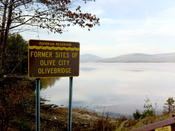
About 100 miles north of Manhattan, roughly halfway between the old Borscht Belt resorts of Sullivan County and the newer ski resorts of Greene County, a manmade lake called the Ashokan Reservoir is nestled in the midst of the Catskill Mountains. Created by a significant feat of modern engineering (when completed in 1911, the dam on the Esopus Creek that created the reservoir was the largest of its kind), the Ashokan today provides a significant portion of New York City’s drinking water. It also provides the opportunity for a pleasant stroll or bike ride along the pedestrian-only area of the dam, with hills in the distance and serene sounds of water lapping at the dam.
Yet, beneath its placid surface, the Ashokan hides a haunted past. The valley was once home to no fewer than ten towns. When the state decided to claim the land, thousands of people were displaced. Among those who had to move were the residents of the local cemeteries (at the rate of $15 per grave, plus an additional $3 per headstone). Some of the towns were physically moved outside of the boundaries of the reservoir, while others (such as Brown’s Station) simply ceased to exist.
Prior to the terrorist attacks of September 11, 2001, it was easy to get down to the surface of the valley when the waters were low. There, along with fossils of ancient organisms like crinoids, ferns, and the occasional trilobite that had washed down from the mountains, you could still find the odd stone foundation from one of the vanished settlements. Access to the area surrounding the reservoir is much more tightly controlled today, but you can still find a sign commemorating the location of Brown’s Station just south of the reservoir on Route 28A, along with several others around the perimeter of the reservoir.
